GIS

Unearthing Solutions to Every Challenge

How Can Vission Help You?

Visualize topography, vegetation, workflows and hazards on your site

Optimize decision making with survey-grade 3D elevation models

Save time and money by avoiding traditional ground, plane and satellite-based surveys

View, share and analyze information on our 3D cloud platform

Identify hot spots and sensitive vegetation with thermal or hyperspectral surveys

Integrate data from across your organization

Imagery Bare Earth Elevations

Our GIS mapping service is built upon a unique foundation of environmental modelling and asset management experience that enables us to serve a wide range of industry sectors.
We offer a comprehensive set of geospatial solutions to fit a client’s specific needs, from Ground Control Points (GCPs) and surveying to data management, processing, analysis and cartography.

Our Process

Survey

Survey

  • LiDAR
  • Photogrammetry  
  • Colour imagery
  • Thermal imagery
  • Multi-spectral
  • Analyse

    Analyse

  • Vegetation classification
  • Spatial analysis
  • Tree removal
  • Image segmentation
  • Least-cost path analysis
  • Digitization of infrastructure and assets
  • Data management
  • Deliver

    Deliver

  • 3D colourized point cloud
  • Bare earth elevation model
  • Surface elevation model
  • Orthophoto
  • Custom maps
  • Our Expertise Spans Decades and Continents

    0
    GIS developers at your service
    0
    Years of spatial solutions
    0
    Years of commercial drone operations
    0
    National headquarters

    Industry Standard Technologies

    LiDAR

    Light Detection and Ranging (LiDAR) technology plays a crucial role in resource operations, landscape planning and mapping. Thanks to its ability to capture and produce highly accurate 3D representations of any surface area on Earth, many industries have become heavily reliant on LiDAR to stay competitive. Applications of LiDAR currently range from mining and agriculture to archaeology and autonomous vehicles.

    Why Drones

    Unmanned aerial vehicles (UAVs) are commonly referred to as drones. They offer several key advantages over satellites as well as manned aircraft such as helicopters or planes. For surveys of smaller areas, drones are significantly more cost-effective. Drones also have no minimum altitude, which means they can achieve much higher resolutions when taking aerial photographs or LiDAR scans. Finally, drones can hover in close proximity to dangerous or difficult-to-reach structures and therefore enable safe inspections of critical infrastructure like powerlines.

    LiDAR is the Future

    Unmanned aerial systems (UAS) and 3D data acquisition tools are undergoing some of the most notable innovations in the world right now. Moving forward, we should see the same kind of remote sensing technology permeating our automobiles, aircraft, trains and soon even spacecraft.

    Our Partners

    Lidar Canada Logo

    LiDAR Canada

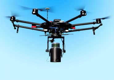
    LiDAR is a team of highly experienced UAV operators with over 10 years of commercial drone experience. They offer aerial surveys with an array of sensors including LiDAR, thermal and multispectral.

    Archibus

    Archibus Inc. is considered the world’s leading provider of real estate and facility management products. The company is an expert at streamlining how you manage your facilities, infrastructure and real estate.

    weltop-logo

    Weltop

    Weltop has provided spatial data analysis and visualization solutions for over 20 years. Their clients include large mining, energy and utility companies.

    Vission Technology is partnered with LiDAR Canada.

    Our aerial surveys are flown by some the nation's most experienced commercial drone pilots.

    About Us

    Our Business

    We provide geospatial data acquisition and analysis for a wide range of industry applications.

    Our Mission

    To help our clients deliver successful projects in an efficient and cost-effective manner.

    Our Team

    Our GIS experts has accumulated years of experience working with projects around the globe.

    Our Goals

    We strive to unlock the true potential of GIS technology and become Canada’s leading provider of GIS solutions and services.

    Our History

    Vission Technology Inc. was founded in August 2017. Our foundation is based on strong partnerships with well-established technology companies in their respective fields. These include ARCHIBUS Inc., the world’s leading provider of real estate and facility management products, and Weltop, a renowned geospatial information service provider based in the Zhong Guan Cun technology hub of Beijing, China.

    Since inception, we have grown our operations team and gained industry recognition throughout Vancouver, Canada – one of the fastest-growing IT communities in the world. Our recent partnership with LiDAR Canada has created a pathway for us to evolve into one of the leading GIS service providers in the country.

    Our Core

    Vission Technology provides geospatial data acquisition, analysis and visualization services for clients across the natural resource and infrastructure sectors. Our staff are experts in LiDAR, photogrammetry, 3D modelling, mapping and enterprise data solutions. Whether planning site access, mapping sensitive wildlife or monitoring tailings ponds, we can rapidly deliver actionable insight and guarantee minimal disruption to your operations.

    1999

    Spatial intelligence software and data solutions

    1999

    2001

    3D mine and infrastructure modelling

    2001

    2008

    Commercial drone operations

    2008

    2012

    Digital elevation modelling

    2012

    2018

    Patented point cloud analysis technology

    2018

    2018

    Photogrammetry and LiDAR services

    2018

    Our Awards

    Vission Technology Inc. was named one of the top 50 companies at the 2019 InterCon conference. Each year InterCon brings together some of the most innovative companies around the world that are using technology to shape the future and drive the global economy.

    100 MOST INNOVATIVE STARTUPS

    Vission Technology Inc. was named one of the 100 most innovative startups in 2019 by The Technology Headlines, a knowledge platform for the global IT community to share insights from some of the brightest minds in the industry.